Lemnitzer Goes on Earthquake Recon Mission
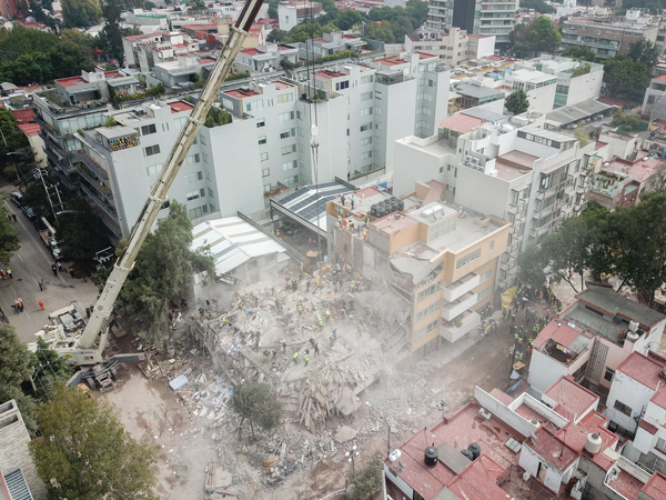
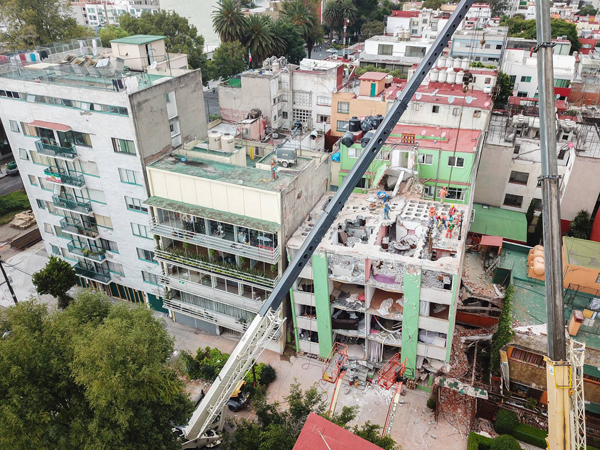
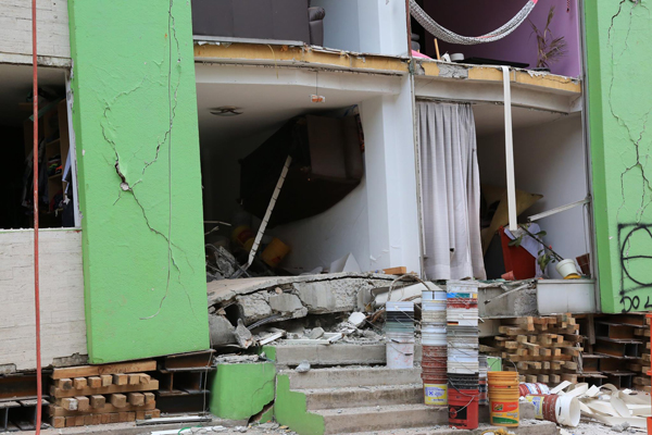
 Oct. 18, 2017 - Anne Lemnitzer traveled to Mexico City five days after the September 19 earthquake struck approximately 60 kilometers southwest of Puebla, Mexico, and 120 kilometers southeast of Mexico City. The magnitude 7.1 earthquake killed 369 people and completely collapsed at least 38 structures, mostly apartment buildings. About a half dozen others were partly collapsed, and hundreds more were seriously damaged.
Why did some buildings fall and others stand? Lemnitzer, a UC Irvine assistant professor of civil and environmental engineering, was there to find out. Immediately following the September 19 event, a joint geotechnical engineering reconnaissance effort was organized between the Universidad Nacional Autónoma de México (UNAM) and the U.S. National Science Foundation (NSF)-sponsored Geotechnical Extreme Events Reconnaissance Association (GEER). Lemnitzer was part of the first team to visit the region, spending three days in the city center and three days south of the city in the epicenter region around Puebla. A second GEER team arrived the following week. The final report is available here.
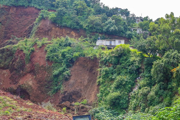
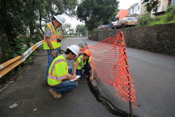
“We investigated failure and success stories,” said Lemnitzer, whose research focus is geotechnical and structural earthquake engineering. The GEER teams assessed buildings (damaged and collapsed), landslides, soil settlement, infrastructure damage, slope instabilities, and dam and embankment performance. Her goal is an improved understanding of why certain structures failed while others resisted. “This knowledge will help us further develop design guidelines and analysis procedures that we can use in the U.S.”
A unique aspect of the Mexico City earthquake is that the city is constructed on the basins of two former lakes. Underground water extraction and urban development caused the lakes to disappear, and left soft soil at the center of the lakebeds that transitions into stiff soil and rock on the outskirts of the city. “It was at the border between the transition zone and the soft soil region where we noticed the most damage and collapse,” said Lemnitzer. “Outside, on the stiffer soil, buildings performed well.”
Lemnitzer explained the problematic soil conditions in Mexico City. “The seismic ground motions appeared to amplify in the transition-zone soils and lake-zone soils. This is expected, as fast traveling waves, which arrive through the underlying rock at a high velocity, cannot travel as fast through the soft soil deposits. Thus, they translate their energy into large wave amplitudes. This effect can be felt as strong ground movement and is the main cause for significant damage to many structures between five and eight stories high in the western part of Mexico City.
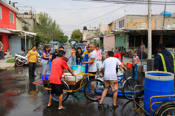
“In some parts of the city, primarily the areas with structures on stiff soils, life continued as normal and very little damage was observed,” she said. “In other parts, there was no electricity and no water. In the poorer neighborhoods, adobe buildings had been severely damaged or collapsed.”
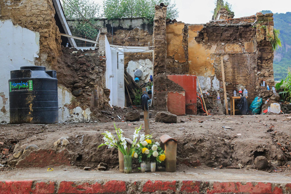
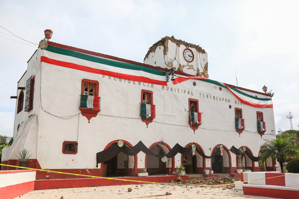
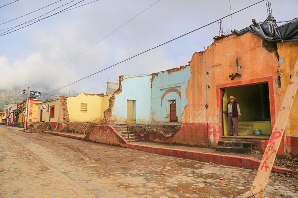
Particularly in regions nearest to the epicenter, such as in the southern states of Puebla and Morelos, the team observed thousands of collapsed dwellings. “This damage was expected, as many residential structures are built with extremely simplified construction techniques, with no compliance to building codes or design standards,” she added. Lemnitzer was impressed with how resilient the people in Mexico were. “We saw neighborhoods coming together to help each other and witnessed thousands of volunteers helping to evacuate and clean up rubble around damaged and collapsed buildings.”
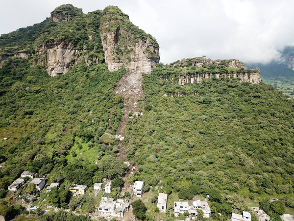
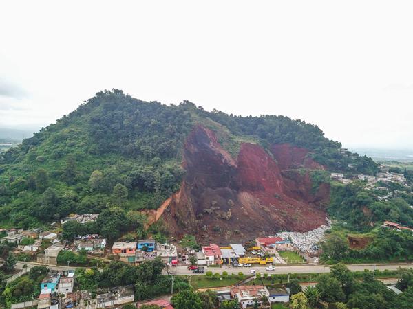
Lemnitzer was one of three on the GEER team to pilot unmanned aerial vehicles (UAVs or drones) for the reconnaissance mission. Together, she, Kevin Franke (Brigham Young University) and Tara Hutchinson (UC San Diego) gathered over 70 gigabytes of high-resolution visual data from collapsed neighborhoods, landslides, rock falls and extensive ground cracking. Drone images, which are used to create 3-D computer models, are particularly precious data as they can capture site damage that can be gone within a few days of the earthquake due to rain, erosion or clean up.
It was the first time the German-born engineer had been to Mexico, but not her first earthquake reconnaissance mission. While a UCLA doctoral student, Lemnitzer conducted a small investigation following the 2008 Chino Hills quake. As a faculty member at California State University, Fullerton, she went to Chile after the 2010 Maule earthquake, where she led a monitoring team that instrumented different building sites for aftershock measurements. “This was particularly interesting as Chile has a similar building code to the U.S. (IBC, ACI 318),” she said.
In 2011, after becoming a UCI faculty member, Lemnitzer joined a team of Japanese researchers to study the aftermath of the 2011 Tohoku earthquake, around the areas of Fukushima.
“It’s difficult to compare the two earthquakes (Mexico and Japan) with each other,” she said. “The tsunami damage was prevalent in Japan, while the structural performance in non-flooded regions was generally good. Japan and the U.S. have similar building codes, and Japan is a leading country in earthquake engineering research. It offered an ideal platform to translate observations back to the U.S. The most recent Mexico earthquake will likely result in several changes to local design code and trigger a more rigorous review and inspection process during design and construction.”
– Lori Brandt