Burke Achieves Distance World Record for Piloting Drone through the Internet

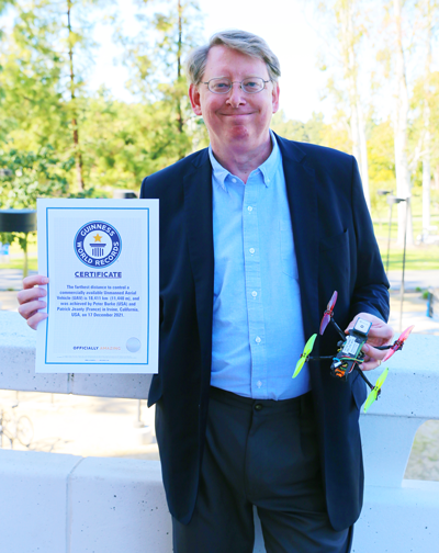
Feb. 9, 2023 - UCI’s Peter Burke and French colleague Patrick Jeanty have earned a Guinness World Record for their demonstration of remotely flying a drone through the internet from halfway around the world. The official Guinness citation reads, “the farthest distance to control a commercially available Unmanned Aerial Vehicle (UAV) at 18,411 kilometers (11,440 miles).” For comparison, the maximum distance between two points on earth is about 12,450 miles.
With Burke, professor of electronic engineering and computer science, on campus at UCI’s Samueli School of Engineering and Jeanty, research engineer at the University of La Réunion ENERGY-Lab, located on the small French island of Réunion in the Indian Ocean off the coast of Africa, they coordinated and videotaped the successful effort on Dec. 17, 2021. They were notified of the world record status on Dec 9, 2022.
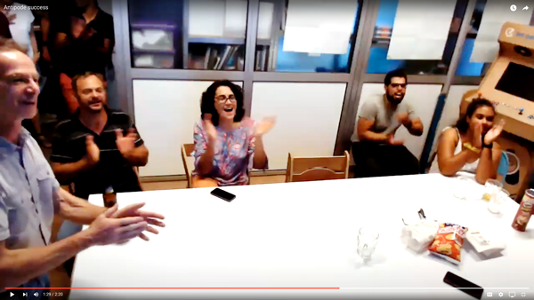
It was early morning in Irvine and early evening in Réunion when Burke placed the small drone in a flying cage set up outside of engineering tower. He had constructed the lightweight (under 250 grams) UAV with off-the-shelf parts and attached a 4G cell phone data modem to the vehicle so it could connect to the internet. On Burke’s cue over Zoom, Jeanty piloted the UAV from Réunion. With a group of students cheering him on in a small conference room, Jeanty activated the drone, flew about six feet vertically for nearly a minute then landed.
“The hard part was how to get the computer on one side of the world to tell the drone on the other side of the world what to do, see, and that’s what we did,” explained Burke, a pioneer in nanoelectronics, who has been working toward this feat with his students for the past few years. He submitted the video with supporting documents to Guinness, and now he has become the first UCI engineering faculty member to hold a Guinness World Record.
“Because the drone is connected and controlled through the internet, its range is practically infinite,” said Burke.

Currently, all commercial drones work with a handheld remote control that connects via radio signal directly to the drone. If UAVs could be controlled over the internet with a phone or computer, it would have numerous applications including search and rescue operations; remote power line and railway safety inspections; water, forest and land surveying, among others.
With a father and brother in the Air Force, Burke has always been interested in aviation and is an avid hobbyist. First, he tried running the radio signal from the remote control to a computer and through the internet to fly the drone. That worked (see published research), so then he took it further and eliminated the handheld remote control altogether, by putting the control software directly on the internet. He tasked a senior engineering student design team with building the web-based drone control station, called Cloudstation.
Lyuyang (Steven) Hu ’20 served as team lead and designed the architecture for the web application. The students’ work was published in the IEEE Journal on Miniaturization for Air and Space Systems in March 2021. A team of graduate students working on their master’s degrees then made improvements to the app in functionality and created tutorials on how to install it.

“CloudStation is built to be used with open-source UAV software and hardware,” said Hu. “The user interface can be accessed through a browser so it provides a convenient way for people who are interested to buy commercially available drones and remotely control them with any mobile device. CloudStation can be adapted to control fleets of aerial, land or sea-based vehicles to collect weather and geographical data or perform search and rescue missions.”
Jeanty, who had met Burke at an IEEE radio and antenna conference in 2019 on Réunion Island, was thrilled to participate in the project. He recruited his colleagues from the local STEM outreach association, called Les Petits Débrouillards de La Réunion. “We followed the procedure that Peter and his students had implemented on their website to control the drone, and when the time came, we pressed the take-off button,” said Jeanty. “It worked! I remember very well seeing Peter get excited and give a thumbs up when the drone was up in the air, controlled by us on the other side of the earth. Then we put the drone back on the ground and everyone applauded. I think it took us a few seconds to really understand what had happened.”
Next, Burke and his current students are working on integrating enhanced remote identification with the internet-based technology to improve safety and collision avoidance, especially important when the drone is out of sight or on the opposite side of the world. The FAA requires that most drones have the ability in flight to provide identification and location information to other parties.
“If we could have drones identify their positions and talk to each other, that would allow us to be able to safely share airspace with other drones and manned aircraft even from very far distances,” said Burke. His work is part of a growing expertise on autonomous vehicles at UCI.
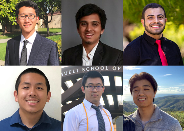
Other contributors to the project include the following students who have all since graduated. In addition to Hu, the undergraduate senior design team members were Omkar Pathak, Zeyu He, Hunkyu Lee, Mina Bedwany and Jace Mica. Master’s thesis team members were Chi Zhang, Lindsey Selena Garcia, Hyun Jay Yang.
– Lori Brandt
