Field Trip Offers Students Firsthand Look at Modern Data Collection Technologies
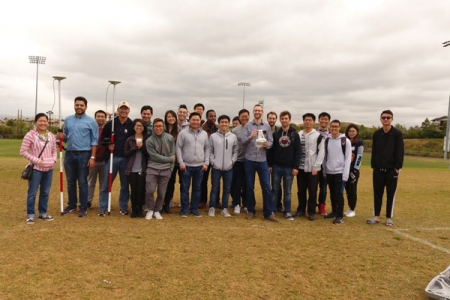
 May 30, 2017 - Phu Nguyen took his class on a field trip to show them how the information they learn in class relates to what happens in the field. Nguyen, a UC Irvine assistant adjunct professor of civil and environmental engineering, teaches Geographic Information Systems (GIS). Both graduate and undergraduate students from civil, environmental and transportation engineering enroll in the course in which they review and process survey and mapping data.
Nguyen and a group of 20 students went to the UCI Anteater Recreation Center sports fields, where they experienced some of the technologies engineers employ to collect surveying and mapping information.
“I wanted the students to see how the methods used for data collection can affect resolution and accuracy, in other words, how well the data represents reality,” said Nguyen. “I am hoping that the next time students look at data, they have a better awareness of what is involved in obtaining it, and if it actually represents what they need to complete their task at hand.”
Guest speaker Jochen Schubert, a GIS and hydraulic modeling research specialist in UCI’s Department of Civil and Environmental Engineering, shared his field data collection knowledge, demonstrated the technologies and walked the students through an exercise using a survey-grade high-accuracy GPS device and an unmanned aerial vehicle (UAV or drone).
With a quadcopter, the students collected 4K resolution images, which were processed to obtain a photographic map, or orthophoto, and a digital elevation model of the upper soccer fields. They used a survey-grade GPS unit to gather point coordinates and elevations of features on the fields, such as intersections of field marks, with approximate horizontal and vertical accuracy of 0.5 meters and 0.6 meters respectively. By overlaying the point measurements onto the orthophoto and terrain models, the students were able to assess how accurately the drone captured spatial information about the soccer field, raising awareness of the benefits and potential constraints of using such systems for field data collection.
Graduate students Joel Sherman and Mohammed Ombadi went on the field trip and deemed it a success as well as “a great shared social experience.”


