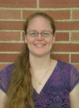
CEE Seminar: Improving Understanding of the Spatial & Temporal Variability of Hydrometeorology & Snow Processes Using Remote Sensing

Postdoctoral Scholar
Civil & Environmental Engineering
University of California, Irvine
Abstract: Globally, large populations heavily rely on seasonal snowmelt derived from mountainous watersheds for the majority of their water resources. However, a high-resolution picture of seasonal snowfall accumulation and orographic enhancement remains a missing piece in our overall understanding of water storage and availability across mountain ranges such as the Sierra Nevada (USA). I present work that overcomes previous data limitations with a new, high-resolution (90-m, daily), multidecadal snow reanalysis over the Sierra Nevada. Results indicate that the Sierra Nevada snowpack accumulates during a relatively short cold season where a few large snowstorms can be the difference between a wet or dry year across the range. With the first multidecadal analysis of basinwide orographic snowfall gradients spanning the entire western Sierra Nevada, we show that this region experiences at least twice as much orographic enhancement during wet years as dry years, on average. I also characterize the extent to which the diagnosed contribution of atmospheric rivers (ARs) to seasonal snowfall is related to the detection method applied, and show that traditional methods may underestimate the relative importance of ARs over this mountain range. Insight into the inter-annual and spatial variability of snowstorms, snowfall distributions and AR-derived snowfall can be used to improve streamflow forecasts, reservoir operations, etc. Potential future directions for quantifying water resources, developing near real-time hydrologic monitoring systems, and improving variability and uncertainty estimates of hydrologic states and land-atmospheric interactions with remote sensing and modeling will be discussed.
Bio: Laurie Huning is currently a postdoctoral scholar in the UC Irvine Department of Civil and Environmental Engineering. She received her bachelor's, master's and doctorate from UCLA in civil engineering. She is the recipient of the NSF Earth Sciences Postdoctoral Fellowship and previously received the NASA Earth and Space Science Graduate Fellowship. Huning is broadly interested in combining remote sensing and modeling to improve characterization of the spatial and temporal variability of hydrologic fluxes and states, land-atmosphere interactions and physical hydrologic processes across a range of scales. In addition, she is interested in enhancing engineering education having developed the open-source MOdular Distributed Watershed Educational Toolbox (MOD-WET) that is currently used at several universities to teach hydrologic concepts. Prior to receiving her Ph.D. in hydrology, she practiced civil engineering in both the private and public sectors in the areas of geotechnical engineering and wastewater conveyance systems engineering.
Share
Upcoming Events
-
MSE 298 Seminar: Ionic Correlations in Polymer Nanostructures - From Block Copolymers to End-Charged Blends
-
MAE 298 SEMINAR: Co-Designing Mutual Aid Transportation for Disaster Resilience
-
CBE 298 Seminar: Engineering Strategies for Structural Heart Disease
-
MSE 298 Seminar: Radiation Resistance and Mechanical Response of Ceramics in Extreme Environments
-
MAE 298 SEMINAR: Stretchable Electronics for Soft Biological and Robotic Systems
